Heimgarten - Herzogstand

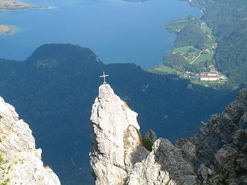
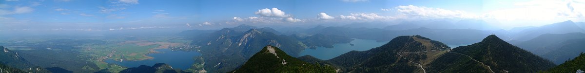
Heimgarten and Herzogstand at lake Walchensee are also popular mountains because of a cabin rope way.
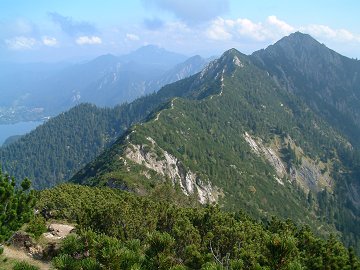
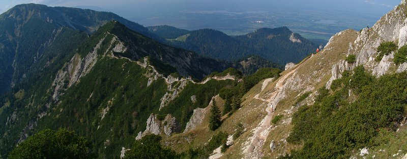
The two mountains are connected by a narrow edge,. where lake Kochelsee and lake Walchensee in view.
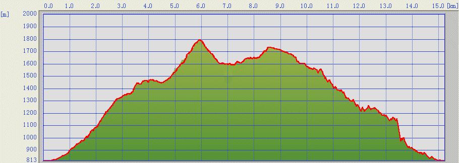
This time we took the round route in the clock-wise direction.
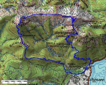

(c)Bayerische Vermessungsverwaltung  i‚s‚n‚o‚T‚Oj
The track was logged by GPS and transferred to the map by editrex2

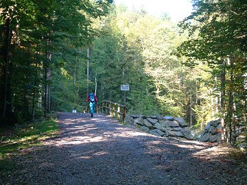
We started from the parking at the rope way station direction to south west. Then we go through a small bridge according to the sign.
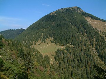
The forest way brought us to a hill, where edge between Heinmgarten and Herzogstand is visible.
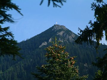
At last Heimgarten can bee seen on the other side of a small pass, to where we have to go down once.
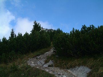
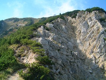
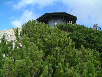
From the pass we go through a steep terrain covered with trees until the hut appears.


Starting from a quiet forest way

A cross is standing on a no-name peak at the edge

Heimgarten

Heimgarten has a hut near the peak

The edge to go is well visible

North-east side of Heimgarten has a different face

Lake Kochelsee from the edge

A small pavilion on Herzogstand

From the peak of Heimgarten, the edge to go over is well observed. Many hikers including kids and dogs are coming from Herzogstand.
Going on the edge is less dangerous as stated in some hiking guides. It is equipped with steel ropes and poles.
It takes only about 1.5 hours from Heimgarten to Herzogstand (Pavilion).
After enjoying the panorama view on the two lakes and other mountains, we went down on the steep way to the parking.


The edge viewed from the east


Fantastic panorama from the peak of Herzogstand; Lace Kochelsee, Benediktenwand, Jochberg, Lake Walchensee and Guffertspitze


Data
30.09.2006
Parking at rope way station (810m, 9:30) -> Heimgarten (1788m, 12:05)
Heimgarten (12:35) -> Herzogstand Pavilion (1731m, 14:05)
Herzogstand Pavilion (14:30) -> Parking at rope way station (16:30)

[Back to Hiking]